 |
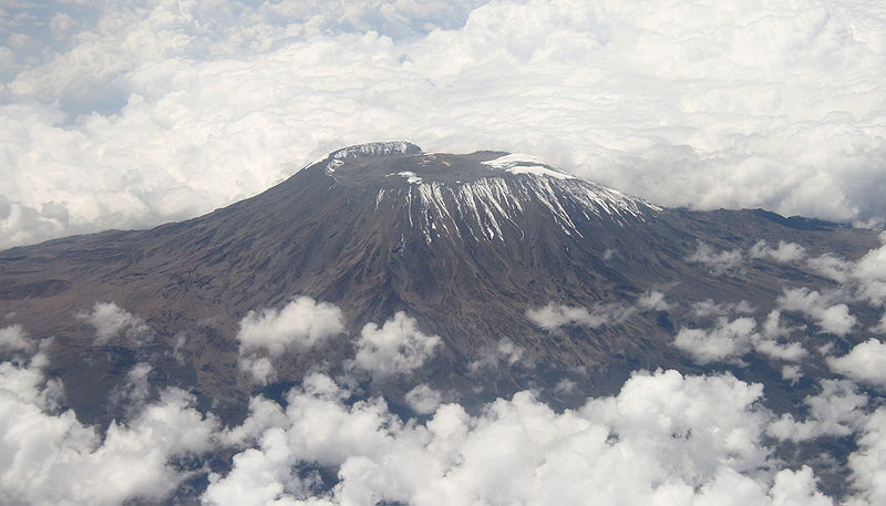
| Mount Kilimanjaro in the Distance |
 |
| Mount Agamenticus in the Distance |
Actually, so does Mount Agamenticus, right here in Maine. Or at least it did. Mount Kilimanjaro started to form about 2.5 million years ago, and its last eruption occurred about 175,000 years ago. While this may be a long time on a human scale, on a geologic scale Kilimanjaro is a young Turk. Imagine Agamenticus on a similar boundary two hundred million years ago: the Maine coast is bidding a fond adieu to the North African shoreline after a short tryst as Pangea and Agamenticus rises 20,000 feet above the western coast. The volcanic center of this rift valley is widening and filling with the water that will someday become the Atlantic Ocean. As it does, streams and ice begin the shortening process of our once giant sentinel. Fast forward a hundred million years - the mountain is smaller, the ocean wider and about halfway to the form we now see. One hundred million more and the mountain is little more than 1/30th its former height, the spreading center nearly 1500 miles away.
Bloom, Arthur L. Geomorphology: A Systematic Analysis of Late Cenozoic Landforms. Upper Saddle River, NJ: Prentice Hall, 1998. Print.
Byran, Wilfred B. "The Mount Agamenticus Conservation Region -." Geology of Mt. A. The Mount Agamenticus Conservation Region. Web. 02 June 2013. <http://www.agamenticus.org/index.php/geology-of-mt-a>.
Girty, G. H. "Chapter 2: Volcanoes." Perilous Earth: Understanding Processes Behind Natural Disasters. Department of Geological Sciences, San Diego State University, June 2009. Web. 1 June 2013. <http://www.geology.sdsu.edu/visualgeology/naturaldisasters/Chapters/Chapter2Volcanoes.pdf>.
Nonnotte, Philippe, Hervé Guillou, Bernard Le Gall, Mathieu Benoit, Joseph Cotten, and Stéphane Scaillet. "New K–Ar Age Determinations of Kilimanjaro Volcano in the North Tanzanian Diverging Rift, East Africa." Journal of Volcanology and Geothermal Research 173.1-2 (2008): 99-112.
Very Cool! I learned something!
ReplyDeleteThanks Lindsey! I'll post more soon.
DeleteBerkunjung kawan, salam perkenalan dara saya. Blog nya bagus, tulisannya juga bermanfaat. kalau ada waktu kunjungi blog saya ya obat herbal asam urat | obat stroke
ReplyDelete